
Photo

The feel of the place
The short answers
The essentials before the detail
When to come
Jun to Aug
4 spots are in season then
Number = how many of the 6 spots are in season that month. 1 spot here names no season at all.
Windiest modelled month
February · 60% of days · West Dennis Beach
The month the wind model rates highest; the season above is when riders and schools go.
modelled
days with three hours in a row at 12 kt or more, between 06:00 and 19:00 local, in February at West Dennis Beach, the strongest month any spot here models
A weather model's cell over this place, not a station on it. Good for comparing places, weaker for one beach.
What it costs
mid to high
Woods Hole-Martha's Vineyard ferry ~$17 round trip
Schools
3
in the directory
Permits & rules
6 spots
with rules of their own for permits, zoning or the bathing season, on the spot cards
Good to know before you go 2
- Bridge traffic onto/off the Cape can be brutal on summer weekends - time your arrival/departure
- A lot of the food/lodging/entertainment infrastructure is seasonal and shuts down outside spring-fall
The spots
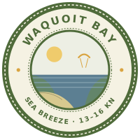
Waquoit Bay
Waquoit Bay, Kbay to the people who ride it, is a shallow estuary on the south shore of Cape Cod between East Falmouth and Mashpee, sitting inside a national estuarine research reserve.
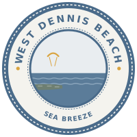
West Dennis Beach
West Dennis Beach is a Cape Cod beach on Nantucket Sound that fills up in summer, with kiters and with everyone else.
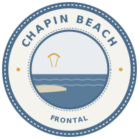
Chapin Beach
Chapin Beach, or Chapin Memorial Beach, is on the north side of Dennis, facing Cape Cod Bay.
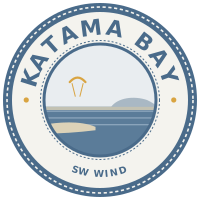
Katama Bay
Katama Bay, Kbay to everyone in Edgartown, is a big shallow bay behind South Beach and Norton Point, and the everyday flat-water session on Martha's Vineyard.
Cape Poge Bay
Cape Poge Bay sits on Chappaquiddick Island, off the eastern side of Martha's Vineyard, and the riding is inside a protected low-lying bay that goes flat when it lines up.
Sengekontacket Pond
Sengekontacket is a shallow salt pond behind Joseph Sylvia State Beach, between Oak Bluffs and Edgartown on Martha's Vineyard.
Schools
3 in the directory
New England Kite School
Doeslessons · foil · wing · shop
RidesWaquoit Bay · West Dennis Beach · Chapin Beach · Pleasure Bay · Dog Beach
nekiteschool.com
Skyhigh Kiteboarding / Skyhigh Windsports
Doeslessons · downwinders · foil · wing
RidesKatama Bay · Cape Poge Bay · Sengekontacket Pond
skyhighkite.com
Next Level Watersports
Doeslessons · rental · foil · wing · camp
RidesKatama Bay · Cape Poge Bay · Sengekontacket Pond
nextlevelwatersports.com
Getting there & around
Nearest airports
- Boston Logan (BOS) is the main gateway, then drive ~1.5-2hr
- Providence (PVD) as an alternative
Car
Transfers
Kite bag rules for your airline
Type the carrier you are flying: what it charges for a kite bag, and the year of the policy that says so.
Checked so far for USA:Southwest AirlinesDelta / American / United
Every carrier, with limits and what riders report at the counter →
Practical
Cash & cards
Internet & working
What riders say
5 recurring claims
The tag says how far the riders who mention it agree; the figure is how many mention it.
Cape Cod is rule-heavy by beach; riders stress designated kite areas, seasonal legality, permits, parking fees, and launch zones more than they do nightlife or kite-camp culture.
consensus6 riders
West Dennis is the Cape spot riders bring up first for a south or southwest day; it has the scene, the beginner-friendly angle, and the crowds that come with both.
consensus5 riders
The Martha's Vineyard side sounds excellent but fussy: Cape Poge is prized for clean flatwater, Senge can be deceptively risky, and shellfish/bird closures can overrule the wind.
majority5 riders
Waquoit is repeatedly framed as the easy shallow-water classroom, but riders should expect patchier bay wind and active boat-channel etiquette.
majority4 riders
Chapin is the north-wind and low-tide playground, with big sand flats, flat water inside, and small wave options beyond the bars.
majority4 riders
The trade-off
- Large, sandy, shallow beginner-friendly learning area
- Flat water at low tide is excellent for technique work
- Wind is patchy/unreliable compared to open-ocean spots
- Cold water even in peak summer
- Boat traffic is an active hazard - must yield right of way
- Short realistic season (roughly late June-mid September)
- High tide brings chop; low tide shrinks the usable area
Wind micro-knowledge
4 facts · Through the season · Wind shadows
Tips from riders
- Never kite into the channel or in front of boats - boats have right of way
- Riders ask locals which shallow spots to avoid while winging in Waquoit, a sign of active informal knowledge-sharing about hazards
Communities
Cape Cod Kiteboarding and Wing Foiling
Scene & life
- Shining Sea Bikeway - a 4-mile mostly-oceanfront bike path from Woods Hole toward Falmouth
- Woods Hole Oceanographic Institution (shops, exhibits)
- Beaches and fishing
- Martha's Vineyard via Woods Hole ferry (~45 min, ~$17 round trip)
- Nantucket (via Hyannis ferry)
Itinerary idea
FAQ
When is the best time to visit?
The season runs roughly April to October, when most lodging and infrastructure are open; summer (Memorial Day to Labor Day) is the busiest and priciest stretch.
Is Cape Cod suitable for beginners?
Yes. West Dennis Beach and Chapin Beach are documented beginner-through-expert spots with shallow, flat-sectioned water, and Waquoit Bay and Martha's Vineyard's Katama Bay offer similarly shallow, protected flat water.
Do you need a car?
Yes. The Cape's towns and beaches are spread out with limited public transit; reaching the Martha's Vineyard spots (Katama Bay, Cape Poge Bay, Sengekontacket Pond) also requires the Woods Hole ferry.
Where should you base yourself?
Falmouth or Woods Hole is the closest walkable town base to Waquoit Bay, with Mashpee nearby for shopping and dining; ferries to Martha's Vineyard leave from Woods Hole.
What does it cost?
Costs run mid to high, especially in peak summer; the Woods Hole-Martha's Vineyard ferry costs about $17 round trip.
How this place scores
Scores out of 10, compared with other places. The data figure under each label is how much of this record that score had to work from, so a high score on thin data is a thin score.
- Flat waterdata 42%10.0
- Safetydata 76%9.3
- Wavesdata 100%8.2
- Beginner friendlydata 78%7.2
- Familydata 100%5.9
- Room on the waterdata 75%5.4
- Off the waterdata 87%4.9
- Kite communitydata 100%4.7
- Ease of accessdata 27%4.0
- Wind reliabilitydata 0%not scored
- Affordabilitydata 0%not scored
- Long staydata 0%not scored
A paler bar was scored from less than half of the record.
Scores by trip type
- Freestyle and flat waterdata 55%8.3
- Wavesdata 70%8.1
- Learning to ridedata 90%7.5
- Family tripdata 100%6.6
- Kite and workdata 20%4.7
Nothing here carries a figure for a long stay, affordability and wind reliability, so every line above is built without them.
Still open
Things we could not verify. If you have ridden here, you can help.
Show the 2 open questions
- How big is the Cape Cod rider group?
- No direct quotes on time-of-day wind pattern found
When to go and nearby places
Last updated: 4 September 2026